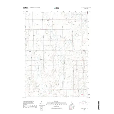
2019 Map of Parkers Corners
USGS Topo · Published 2019About this map
Parkers Corners anchors this rural landscape in Livingston County, where agricultural patterns are intersected by an extensive network of drainage infrastructure. The hydrologic character of the region is defined by the Middle Br Red Cedar River and various man-made watercourses such as Iosco Drain Number Three and the Marion Iosco Drain. This drainage system, essential for the local farming economy, sits alongside a high concentration of small family and community burial grounds, including Paige Cem, Loree Cem, and Munsell Cem, which provide significant touchpoints for genealogical research. Aviation interests are represented by the Cloud Nine East Airport, while the southern reaches of the quadrangle transition toward the wetlands surrounding Mud Lake and the County Ditch Number Seven. The map reveals how the land has been partitioned and managed for water control while preserving a dense record of early settlement history through its many cemeteries.
Find a feature on this map
95 named features on this map. Tap any name to fly to it.
Don’t see what you’re looking for? This feature index may not catch every label — zoom into the map to look around manually.
Map Details
Editions of this 2019 Parkers Corners Map
This is the sole edition of this map. No revisions or reprints were ever made.
Other maps of this area

1902 · Dexter
USGS Topo · 1:62,500

1904 · Ann Arbor
USGS Topo · 1:125,000

1906 · Dexter
USGS Topo · 1:62,500

1907 · Howell
USGS Topo · 1:62,500

1908 · Ann Arbor
USGS Topo · 1:125,000

1908 · Fowlerville
USGS Topo · 1:62,500

1909 · Howell
USGS Topo · 1:62,500

1910 · Fowlerville
USGS Topo · 1:62,500

1919 · Stockbridge
USGS Topo · 1:62,500

1922 · Stockbridge
USGS Topo · 1:62,500