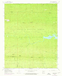
1963 Map of Paron SW
USGS Topo · Published 1976About this map
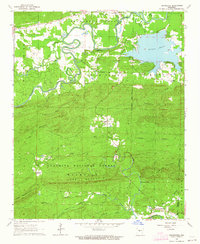
Lake Winona and the surrounding wilderness of the Ouachita National Forest define this landscape on the border of Saline, Perry, and Garland counties. The topography is marked by distinctive high points and sharp ridges, including the prominent Flatside Pinnacle and White Oak Mountain. A complex network of watercourses, such as the Alum Fork Saline River and Stillhouse Creek, cuts through the forest, feeding into the reservoir.
Find a feature on this map
33 named features on this map. Tap any name to fly to it.
Don’t see what you’re looking for? This feature index may not catch every label — zoom into the map to look around manually.
Map Details
Editions of this 1963 Paron SW Map
5 editions found
Other maps of this area

1890 · Benton
USGS Topo · 1:125,000

1890 · Hot Springs
USGS Topo · 1:125,000

1894 · Hot Springs
USGS Topo · 1:125,000

1894 · Benton
USGS Topo · 1:125,000

1955 · Little Rock
USGS Topo · 1:250,000

1956 · Little Rock
USGS Topo · 1:250,000

1960 · Little Rock
USGS Topo · 1:250,000

1963 · Paron SW
USGS Topo · 1:24,000
1963 · Thornburg
USGS Topo · 1:24,000
1963 · Aplin
USGS Topo · 1:24,000