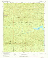
1963 Map of Paron SW
USGS Topo · Published 1984About this map
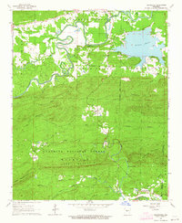
Ouachita National Forest dominates this topographic landscape in the early 1960s, a region defined by high points and complex drainage systems. The Lake Winona reservoir is a central feature, collecting waters from the Alum Fork Saline River and various tributaries like Stillhouse Creek and Horseley Branch. Significant topographic landmarks are noted across the terrain, including Flatside Pinnacle, Bread Creek Pinnacle, and Wolf Pinnacle, which serve as distinctive geographic markers for the area.
Find a feature on this map
29 named features on this map. Tap any name to fly to it.
Don’t see what you’re looking for? This feature index may not catch every label — zoom into the map to look around manually.
Map Details
Editions of this 1963 Paron SW Map
5 editions found
Other maps of this area

1890 · Benton
USGS Topo · 1:125,000

1890 · Hot Springs
USGS Topo · 1:125,000

1894 · Hot Springs
USGS Topo · 1:125,000

1894 · Benton
USGS Topo · 1:125,000

1955 · Little Rock
USGS Topo · 1:250,000

1956 · Little Rock
USGS Topo · 1:250,000

1960 · Little Rock
USGS Topo · 1:250,000

1963 · Paron SW
USGS Topo · 1:24,000
1963 · Thornburg
USGS Topo · 1:24,000
1963 · Aplin
USGS Topo · 1:24,000