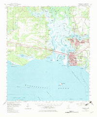
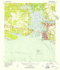
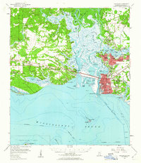
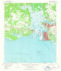
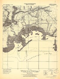
1955 Map of Pascagoula
USGS Topo · Published 1982About this map
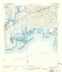
Pascagoula and Moss Point serve as the industrial and maritime hubs of this coastal Mississippi landscape, dominated by the intricate confluence of the Pascagoula River and the Escatawpa River. The map details a dense network of schools, from Magnolia High Sch to Beach Sch, alongside civic landmarks like the County Fairground and Hospital. Cultural history is evident in the Old Spanish Fort Cem and Belle Fontaine Ch, reflecting the area's long-standing settlement patterns along the Mississippi Sound. The southern edge of the survey reaches out to Round Island, where a Lighthouse (Abandoned) stands near the Pascagoula Channel. Transportation and industry are anchored by the Louisville and Nashville railroad and a prominent Brickyard near Escatawpa, showing the transition from river-based commerce to rail and road development.
Find a feature on this map
105 named features on this map. Tap any name to fly to it.
Don’t see what you’re looking for? This feature index may not catch every label — zoom into the map to look around manually.
Map Details
Editions of this 1955 Pascagoula Map
4 editions found
Other maps of this area
1921 · Grand Bay
USGS Topo · 1:62,500

1921 · Petit Bois Island
USGS Topo · 1:62,500

1941 · Hurley
USGS Topo · 1:62,500

1941 · Vancleave
USGS Topo · 1:62,500
1941 · Horn Island
USGS Topo · 1:62,500

1942 · Petit Bois Island
USGS Topo · 1:62,500
1942 · Horn Island
USGS Topo · 1:62,500
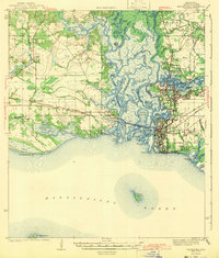
1943 · Pascagoula
USGS Topo · 1:62,500
1943 · Grand Bay
USGS Topo · 1:62,500
1943 · Hurley
USGS Topo · 1:62,500