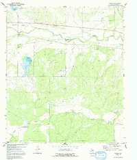
1970 Map of Pasche
USGS Topo · Published 1992About this map
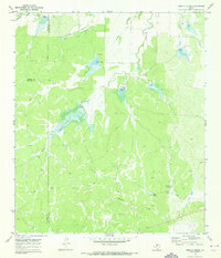
Brady Mountains dominate the northeastern corner of this Concho County landscape, overlooking a series of drainage systems that define the local topography. The small settlement of Pasche sits centrally, serving as a focal point along the east-west corridor of Route 87. This 1970 survey records the rural character of the region, where the winding courses of Brady Creek, South Brady Creek, and Maverick Creek create a deeply dissected terrain of draws and ridges. Local family history is anchored at the Sudduth Cem located west of the main settlement. The land use is reflected in several Gravel Pit operations and a Roadside Park along the highway, while the presence of a Well and water control features like the Spillway at the Riser impoundment illustrate the critical role of water management in this part of Central Texas.
Find a feature on this map
12 named features on this map. Tap any name to fly to it.
Don’t see what you’re looking for? This feature index may not catch every label — zoom into the map to look around manually.
Map Details
Editions of this 1970 Pasche Map
2 editions found
Other maps of this area

1892 · Eden
USGS Topo · 1:125,000

1896 · Eden
USGS Topo · 1:125,000

1931 · Stacy
USGS Topo · 1:62,500

1954 · Brownwood
USGS Topo · 1:250,000

1960 · Melvin
USGS Topo · 1:24,000

1967 · Millersview SE
USGS Topo · 1:24,000
1967 · Salt Gap
USGS Topo · 1:24,000
1967 · Doole SW
USGS Topo · 1:24,000

1970 · Callan
USGS Topo · 1:24,000
1970 · Needle Creek
USGS Topo · 1:24,000