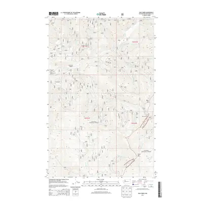
2014 Map of Pass Creek
USGS Topo · Published 2014About this map
Colville National Forest and Kanisku National Forest converge in this high-altitude corner of the Selkirk Mountains. The landscape is defined by its dramatic verticality, with prominent peaks like Hall Mtn and Round Top Mtn overlooking a dense network of watercourses including Sullivan Cr and Harvey Cr. The presence of the Last Chance Cabin near Pass Creek Pass indicates a history of rugged mountain utility, while established sites like Sullivan Creek Campground Number 2 and Sullivan Creek Campground Number 3 mark the area's modern role as a destination for back-country recreation. Numerous drainages such as Totem Gulch and Conto Gulch feed into the complex system of creeks that shape these national forest lands.
Find a feature on this map
38 named features on this map. Tap any name to fly to it.
Don’t see what you’re looking for? This feature index may not catch every label — zoom into the map to look around manually.
Map Details
Editions of this 2014 Pass Creek Map
This is the sole edition of this map. No revisions or reprints were ever made.
Other maps of this area

1934 · Metaline
USGS Topo · 1:125,000

1942 · Metaline
USGS Topo · 1:125,000

1958 · Sandpoint
USGS Topo · 1:250,000

1963 · Sandpoint
USGS Topo · 1:250,000

1967 · Gypsy Peak
USGS Topo · 1:24,000

1967 · Scotchman Lake
USGS Topo · 1:24,000

1967 · Boundary Dam
USGS Topo · 1:24,000

1967 · Salmo Mtn.
USGS Topo · 1:24,000

1967 · Metaline Falls
USGS Topo · 1:24,000

1967 · Monumental Mtn.
USGS Topo · 1:24,000