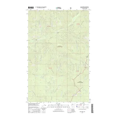
2017 Map of Pass Creek
USGS Topo · Published 2017About this map
Hall Mountain and the high ridges of the Shedroof Divide dominate this high-altitude landscape where the Colville National Forest meets the Kaniksu National Forest. The map documents a complex network of drainage basins and mountain passes, notably Pass Creek Pass and the long ridgeline known as Hall Mtn - Grassy Top. This 2017 survey reveals the extensive forest management infrastructure of the era, defined by numerous National Forest Development Roads like Nat For Dev Rd 2212 and Nat For Dev Rd 300 that snake through steep drainages. Significant water features like Sullivan Creek and its many tributaries, including Kinyon Creek and Mankato Creek, illustrate the rugged hydrological profile of the Selkirk Mountains. The map provides a clear record of the area's geography, from Totem Gulch in the north to the headwaters of Harvey Creek in the south.
Find a feature on this map
49 named features on this map. Tap any name to fly to it.
Don’t see what you’re looking for? This feature index may not catch every label — zoom into the map to look around manually.
Map Details
Editions of this 2017 Pass Creek Map
This is the sole edition of this map. No revisions or reprints were ever made.
Other maps of this area

1934 · Metaline
USGS Topo · 1:125,000

1942 · Metaline
USGS Topo · 1:125,000

1958 · Sandpoint
USGS Topo · 1:250,000

1963 · Sandpoint
USGS Topo · 1:250,000

1967 · Gypsy Peak
USGS Topo · 1:24,000

1967 · Scotchman Lake
USGS Topo · 1:24,000

1967 · Boundary Dam
USGS Topo · 1:24,000

1967 · Salmo Mtn.
USGS Topo · 1:24,000

1967 · Metaline Falls
USGS Topo · 1:24,000

1967 · Monumental Mtn.
USGS Topo · 1:24,000