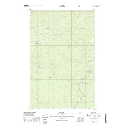
2020 Map of Pass Creek
USGS Topo · Published 2020About this map
The Colville National Forest and Kaniksu National Forest converge in this high-altitude corner of the Selkirk Mountains. The landscape is defined by the Shedroof Divide, a prominent ridge line that separates drainage systems and dictates the path of the Nordman-Metaline route. Notable peaks like Hall Mountain, Grassy Top Mtn, and Round Top Mtn anchor the terrain, while the Pass Creek Pass provides a critical transition point between steep valleys.
Find a feature on this map
46 named features on this map. Tap any name to fly to it.
Don’t see what you’re looking for? This feature index may not catch every label — zoom into the map to look around manually.
Map Details
Editions of this 2020 Pass Creek Map
This is the sole edition of this map. No revisions or reprints were ever made.
Other maps of this area

1934 · Metaline
USGS Topo · 1:125,000

1942 · Metaline
USGS Topo · 1:125,000

1958 · Sandpoint
USGS Topo · 1:250,000

1963 · Sandpoint
USGS Topo · 1:250,000

1967 · Gypsy Peak
USGS Topo · 1:24,000

1967 · Scotchman Lake
USGS Topo · 1:24,000

1967 · Boundary Dam
USGS Topo · 1:24,000

1967 · Salmo Mtn.
USGS Topo · 1:24,000

1967 · Metaline Falls
USGS Topo · 1:24,000

1967 · Monumental Mtn.
USGS Topo · 1:24,000