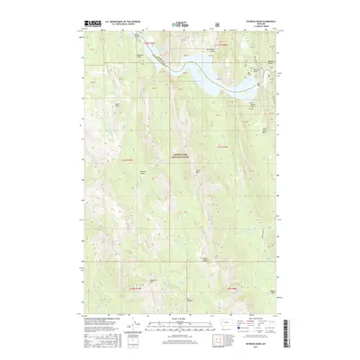
2017 Map of Patricks Basin
USGS Topo · Published 2017About this map
Lewis & Clark National Forest encompasses this high-altitude landscape, where the Sun River enters the Gibson Reservoir. The northern terrain is defined by dramatic verticality at Elbow Gorge and the prominent Elephant Head peak. Further south, the map details the high meadows and drainage basins of Patricks Basin and Beaver Basin, separated by the heights of Allan Mtn. The hydrology of this area is complex, featuring numerous named springs and waterfalls such as Scattering Springs and Lange Falls. Evidence of remote forest management and high-country grazing is seen at the Sheep Sheds near Buckroot Cr. The map provides a clear record of the boundary between Teton and Lewis and Clark Counties as it crosses the reservoir, alongside a network of trails and secondary forest roads like the Beaver Willow Rd that navigate the steep timber basins.
Find a feature on this map
44 named features on this map. Tap any name to fly to it.
Don’t see what you’re looking for? This feature index may not catch every label — zoom into the map to look around manually.
Map Details
Editions of this 2017 Patricks Basin Map
This is the sole edition of this map. No revisions or reprints were ever made.
Other maps of this area

1903 · Saypo
USGS Topo · 1:125,000

1903 · Coopers Lake
USGS Topo · 1:125,000

1955 · Choteau
USGS Topo · 1:250,000

1957 · Choteau
USGS Topo · 1:250,000

1958 · Choteau
USGS Topo · 1:250,000

1958 · Sawtooth Ridge
USGS Topo · 1:24,000

1958 · Glenn Creek
USGS Topo · 1:24,000

1958 · Pretty Prairie
USGS Topo · 1:24,000

1958 · Patricks Basin
USGS Topo · 1:24,000

1958 · Castle Reef
USGS Topo · 1:24,000