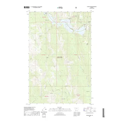
2020 Map of Patricks Basin
USGS Topo · Published 2020About this map
Lewis and Clark National Forest encompasses this high-altitude landscape where the Sawtooth Range meets the drainages of the N Fork Sun River. The hydrography is dominated by the Gibson Reservoir in the north and a network of high-country creeks including Lange Cr and Stovepipe Cr. Notable geological and topographic markers include the sheer Black Reef and the dramatic Elbow Gorge, while the namesake Patricks Basin sits centrally among peaks like Allan Mtn. Human presence in this wilderness is evidenced by the Beaver Willow Rd in the east and specific local sites such as the Sheep Sheds near Benchmark Cr. This map traces the transition from the open waters of the reservoir to the high summits of Renshaw Mtn and Burn Top Mtn, providing a precise record of the trail and water systems within this protected forest boundary.
Find a feature on this map
49 named features on this map. Tap any name to fly to it.
Don’t see what you’re looking for? This feature index may not catch every label — zoom into the map to look around manually.
Map Details
Editions of this 2020 Patricks Basin Map
This is the sole edition of this map. No revisions or reprints were ever made.
Other maps of this area

1903 · Saypo
USGS Topo · 1:125,000

1903 · Coopers Lake
USGS Topo · 1:125,000

1955 · Choteau
USGS Topo · 1:250,000

1957 · Choteau
USGS Topo · 1:250,000

1958 · Choteau
USGS Topo · 1:250,000

1958 · Sawtooth Ridge
USGS Topo · 1:24,000

1958 · Glenn Creek
USGS Topo · 1:24,000

1958 · Pretty Prairie
USGS Topo · 1:24,000

1958 · Patricks Basin
USGS Topo · 1:24,000

1958 · Castle Reef
USGS Topo · 1:24,000