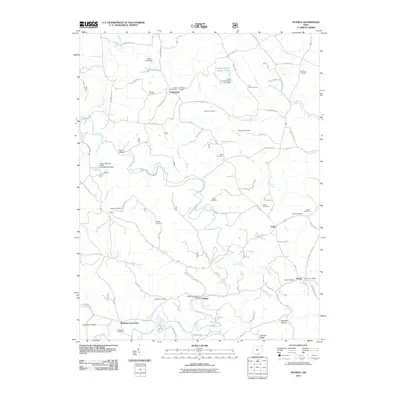
2011 Map of Patriot
USGS Topo · Published 2011About this map
Symmes Creek winds through this rural pocket of Gallia County, carving a landscape defined by its many tributaries like Trace Creek and Sand Fork. The area is characterized by a high density of local burial grounds, serving as a primary genealogical resource for the region. Named family and community sites such as Tyn Rhos Cemetery, Wiseman Cemetery, and Siloam Cemetery are scattered across the uplands, linked by narrow country roads like Pioneer Trail Rd.
Find a feature on this map
99 named features on this map. Tap any name to fly to it.
Don’t see what you’re looking for? This feature index may not catch every label — zoom into the map to look around manually.
Map Details
Editions of this 2011 Patriot Map
This is the sole edition of this map. No revisions or reprints were ever made.
Other maps of this area

1898 · Ironton
USGS Topo · 1:62,500

1900 · Ironton
USGS Topo · 1:62,500

1906 · Bidwell
USGS Topo · 1:62,500

1906 · Athalia
USGS Topo · 1:62,500

1908 · Bidwell
USGS Topo · 1:62,500

1908 · Athalia
USGS Topo · 1:62,500

1912 · Oak Hill
USGS Topo · 1:62,500

1957 · Huntington
USGS Topo · 1:250,000

1960 · Huntington
USGS Topo · 1:250,000
1961 · Oak Hill
USGS Topo · 1:24,000