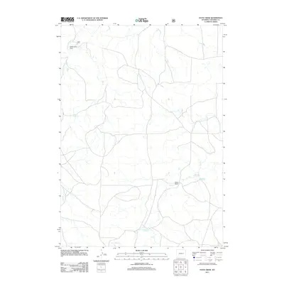
2012 Map of Patsy Draw
USGS Topo · Published 2012About this map
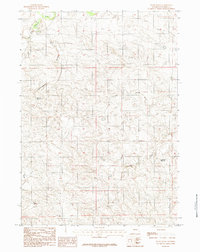
Tillard Ranch sits in the northwestern corner of this landscape, representing the long-standing ranching tradition of eastern Wyoming. This high plains area is defined by a network of intermittent watercourses and draws, essential for managing water in a semi-arid environment. The Dry Fork Cheyenne River enters near the top, while the eponymous Patsy Draw and Cottonwood Draw score the terrain. The importance of water storage for livestock and local use is evident in the numerous small impoundments scattered across the sheet, including Madsen Reservoir, Ballard Reservoir, and Anderson Reservoir. In the southern reaches, the Dry Creek Number 1 Reservoir captures seasonal flow from Dry Cr, reflecting the sophisticated water management systems required to sustain operations in Converse County during the early 21st century.
Find a feature on this map
10 named features on this map. Tap any name to fly to it.
Don’t see what you’re looking for? This feature index may not catch every label — zoom into the map to look around manually.
Map Details
Editions of this 2012 Patsy Draw Map
This is the sole edition of this map. No revisions or reprints were ever made.
Other maps of this area

1955 · Newcastle
USGS Topo · 1:250,000

1958 · Newcastle
USGS Topo · 1:250,000

1959 · Bill
USGS Topo · 1:62,500

1959 · Betty Reservoir
USGS Topo · 1:62,500

1959 · Coal Draw
USGS Topo · 1:62,500
1959 · Highland Flats
USGS Topo · 1:62,500

1979 · Bill
USGS Topo · 1:100,000
1984 · Bobby Draw
USGS Topo · 1:24,000
1984 · Whipple Hollow
USGS Topo · 1:24,000
1984 · Patsy Draw
USGS Topo · 1:24,000