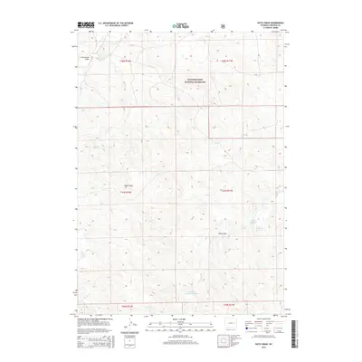
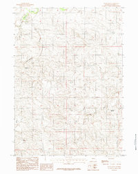
2015 Map of Patsy Draw
USGS Topo · Published 2015About this map
Thunder Basin National Grassland dominates the northern reaches of this Converse County landscape, where the high plains are carved by seasonal drainages and ephemeral water storage. The hydrological network is defined by the Dry Fork Cheyenne River and several named draws including Cottonwood Draw, Poison Draw, and the eponymous Patsy Draw. These features suggest a topography of intermittent flow, where cattle ranching and land management rely on a series of small impoundments. Notable man-made water features such as Madsen Reservoir, Ballard Reservoir, and Anderson Reservoir are scattered across the terrain, reflecting the critical importance of water conservation in this arid Wyoming environment. The map also traces the meandering paths of Skunk Cr and Dry Cr as they cut through the grassland's undulating surface.
Find a feature on this map
17 named features on this map. Tap any name to fly to it.
Don’t see what you’re looking for? This feature index may not catch every label — zoom into the map to look around manually.
Map Details
Editions of this 2015 Patsy Draw Map
This is the sole edition of this map. No revisions or reprints were ever made.
Other maps of this area

1955 · Newcastle
USGS Topo · 1:250,000

1958 · Newcastle
USGS Topo · 1:250,000

1959 · Bill
USGS Topo · 1:62,500

1959 · Betty Reservoir
USGS Topo · 1:62,500

1959 · Coal Draw
USGS Topo · 1:62,500
1959 · Highland Flats
USGS Topo · 1:62,500

1979 · Bill
USGS Topo · 1:100,000
1984 · Bobby Draw
USGS Topo · 1:24,000
1984 · Whipple Hollow
USGS Topo · 1:24,000
1984 · Patsy Draw
USGS Topo · 1:24,000