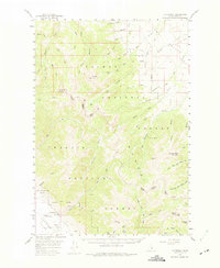
1956 Map of Patterson
USGS Topo · Published 1975About this map
Patterson sits at the foot of the Salmon River Mountains in this mid-century survey of the Pahsimeroi Valley. The landscape is defined by its mining and aviation history, centered on the Ima Mine and the nearby Patterson Airport. High-altitude benchmarks like Mill Mtn and Gunsight Peak tower over a network of drainages including Eightmile Creek and Patterson Creek. The presence of a Tunnel and various prospects such as the Blue Jay Mine and Ray Lode Mine indicate the area's intensive mineral exploration within the Challis National Forest. Named landmarks like Bates and Smith are situated along Mill Creek, while the eastern boundary is marked by the high ridges of the Lemhi Valley.
Find a feature on this map
56 named features on this map. Tap any name to fly to it.
Don’t see what you’re looking for? This feature index may not catch every label — zoom into the map to look around manually.
Map Details
Editions of this 1956 Patterson Map
2 editions found
Other maps of this area

1935 · Borah Peak
USGS Topo · 1:125,000

1938 · Borah Peak
USGS Topo · 1:125,000

1955 · Dubois
USGS Topo · 1:250,000

1956 · Leadore
USGS Topo · 1:62,500

1956 · Patterson
USGS Topo · 1:62,500

1956 · Donkey Hills
USGS Topo · 1:62,500

1956 · Doublespring
USGS Topo · 1:62,500

1956 · May
USGS Topo · 1:62,500

1956 · Lemhi
USGS Topo · 1:62,500

1957 · Gilmore
USGS Topo · 1:62,500