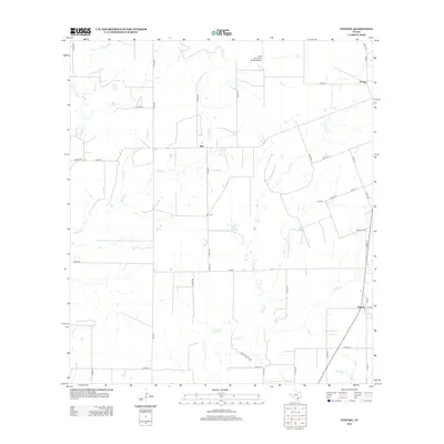
2012 Map of Pawnee
USGS Topo · Published 2012About this map
The community of Nell serves as a central point in this South Texas landscape, where the rural road network converges near Nell Cem. This 2012 survey illustrates the enduring agricultural and ranching character of the region, defined by the winding paths of Weedy Cr and its tributaries like Little Cr. The presence of the San Christoval Ranch Airport in the northern reach suggests the importance of private aviation for managing these large ranch holdings. Near the eastern edge, the settlement of Pawnee and Pawnee Cem mark another pocket of local history, while the small enclave of El Oso sits near the northern boundary. Numerous seasonal drainages including Sulphur Cr and Elm Cr cross the terrain, often flanked by small stock tanks and Arnold Lake, reflecting the vital role of water management in this cattle-country environment.
Find a feature on this map
49 named features on this map. Tap any name to fly to it.
Don’t see what you’re looking for? This feature index may not catch every label — zoom into the map to look around manually.
Map Details
Editions of this 2012 Pawnee Map
This is the sole edition of this map. No revisions or reprints were ever made.
Other maps of this area

1931 · Falls City
USGS Topo · 1:62,500

1936 · Pettus
USGS Topo · 1:62,500

1953 · Crystal City
USGS Topo · 1:250,000

1953 · Beeville
USGS Topo · 1:250,000

1955 · Crystal City
USGS Topo · 1:250,000

1956 · Suniland
USGS Topo · 1:62,500

1956 · Beeville
USGS Topo · 1:250,000

1956 · Pettus
USGS Topo · 1:62,500

1956 · Karnes City
USGS Topo · 1:62,500

1960 · Beeville
USGS Topo · 1:250,000