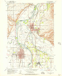
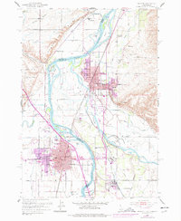
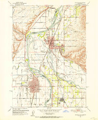
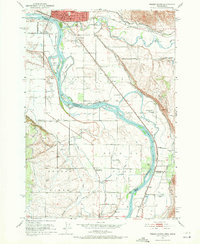
1951 Map of Payette
USGS Topo · Published 1957About this map
The confluence of the Snake River, Payette River, and Malheur River defines this western Idaho and eastern Oregon borderland. This mid-century survey highlights the dense irrigation network supporting local agriculture, including the Dead Ox Canal and Brossman Ditch. The urban centers of Payette and Ontario are shown in detail, connected by the Union Pacific Railroad and the Oregon-Washington Railroad & Navigation Co.
Find a feature on this map
81 named features on this map. Tap any name to fly to it.
Don’t see what you’re looking for? This feature index may not catch every label — zoom into the map to look around manually.
Map Details
Editions of this 1951 Payette Map
3 editions found
Other maps of this area

1897 · Weiser
USGS Topo · 1:125,000

1898 · Nampa
USGS Topo · 1:125,000

1906 · Mitchell Butte
USGS Topo · 1:125,000
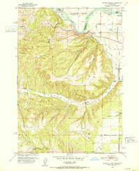
1951 · Moores Hollow
USGS Topo · 1:24,000

1951 · Malheur Butte
USGS Topo · 1:24,000

1951 · Moores Hollow
USGS Topo · 1:62,500
1951 · Payette
USGS Topo · 1:24,000
1951 · Weiser South
USGS Topo · 1:24,000

1952 · Weiser Cove
USGS Topo · 1:24,000
1952 · Birding Island
USGS Topo · 1:24,000