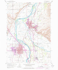
1951 Map of Payette
USGS Topo · Published 1977About this map
The Snake River forms a winding border between Idaho and Oregon on this 1951 survey, revised with 1974 aerial data to show the expanding footprints of Payette and Ontario. This riverine landscape is defined by its complex irrigation network, including the Washoe Canal and Pioneer Ditch, which support the agricultural valley between Snow Mountain and the water. The map documents a significant era of post-war development, visible in the growth of Fruitland and the establishment of institutions like Treasure Valley Community College.
Find a feature on this map
63 named features on this map. Tap any name to fly to it.
Don’t see what you’re looking for? This feature index may not catch every label — zoom into the map to look around manually.
Map Details
Editions of this 1951 Payette Map
3 editions found
Other maps of this area

1897 · Weiser
USGS Topo · 1:125,000

1898 · Nampa
USGS Topo · 1:125,000

1906 · Mitchell Butte
USGS Topo · 1:125,000

1951 · Moores Hollow
USGS Topo · 1:24,000

1951 · Malheur Butte
USGS Topo · 1:24,000

1951 · Moores Hollow
USGS Topo · 1:62,500

1951 · Payette
USGS Topo · 1:24,000

1951 · Weiser South
USGS Topo · 1:24,000

1952 · Weiser Cove
USGS Topo · 1:24,000

1952 · Birding Island
USGS Topo · 1:24,000