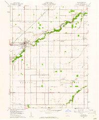
1960 Map of Payne
USGS Topo · Published 1961About this map
Payne serves as the central hub of this agricultural landscape in Paulding County, where the New York Chicago and St Louis railroad cuts a straight diagonal across the terrain. The map reveals a highly managed environment of drainage ditches, such as Zielke Ditch and Buchanan Ditch, which support the farmstead grid between the winding paths of Flatrock Creek and Blue Creek. Small rural communities like Worstville and Briceton appear alongside the rail line, while the hinterlands are dotted with local landmarks like Grange Hall and St Pauls Ch. Genealogists will find significant value in the distribution of family-named burial grounds, including Snellenbarger Cem, Wiltsie Cem, Lehman Cem, and Deatley Cem, which anchor the history of the surrounding townships.
Find a feature on this map
24 named features on this map. Tap any name to fly to it.
Don’t see what you’re looking for? This feature index may not catch every label — zoom into the map to look around manually.
Map Details
Editions of this 1960 Payne Map
2 editions found
Other maps of this area

1914 · Van Wert
USGS Topo · 1:62,500

1914 · Paulding
USGS Topo · 1:62,500

1944 · Van Wert
USGS Topo · 1:62,500

1944 · Paulding
USGS Topo · 1:62,500

1953 · Fort Wayne
USGS Topo · 1:250,000

1953 · Muncie
USGS Topo · 1:250,000

1956 · Muncie
USGS Topo · 1:250,000

1956 · Fort Wayne
USGS Topo · 1:250,000

1958 · Woodburn North
USGS Topo · 1:24,000

1958 · Woodburn South
USGS Topo · 1:24,000