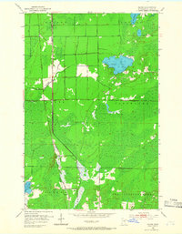
1953 Map of Payne
USGS Topo · Published 1966About this map
The Duluth Missabe and Iron Range railroad forms the central spine of this landscape, driving the development of small railside communities like Payne and Birch. This mid-century survey reveals a region defined by extensive lowlands and peat bogs, characteristic of St. Louis County, where human settlement is closely tied to the high ground along the iron ore transport corridors. At Alborn and Baden, the transition from forested wetlands to small clearings marks the intersection of local logging or agricultural efforts with the industrial reach of the railway.
Find a feature on this map
16 named features on this map. Tap any name to fly to it.
Don’t see what you’re looking for? This feature index may not catch every label — zoom into the map to look around manually.
Map Details
Editions of this 1953 Payne Map
3 editions found
Other maps of this area

1953 · Canyon
USGS Topo · 1:24,000

1953 · Payne
USGS Topo · 1:24,000

1953 · Alborn
USGS Topo · 1:24,000

1953 · Independence
USGS Topo · 1:24,000

1953 · Brookston NW
USGS Topo · 1:24,000

1953 · Duluth
USGS Topo · 1:250,000

1954 · Hibbing
USGS Topo · 1:250,000

1956 · Cotton
USGS Topo · 1:24,000

1957 · Hibbing
USGS Topo · 1:250,000

1958 · Hibbing
USGS Topo · 1:250,000