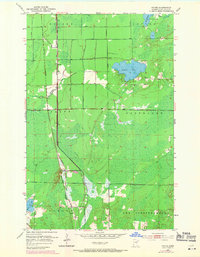
1953 Map of Payne
USGS Topo · Published 1971About this map
The Duluth Missabe and Iron Range railroad bisects this section of St. Louis County, serving as a primary corridor through the lowlands north of the Iron Range. The small settlement of Payne sits at a junction with the Burlington Northern line, while the community of Bireh is located further south. This landscape is defined by its water and industry, with the Little Whiteface River and Jenkins Cr draining into extensive wetland areas. Resource extraction is evident near the center of the quadrangle, where several Gravel Pits are located. To the northeast, Nichols Lake and Lake Williams break the dense forest cover, while Maple Leaf Lake sits in the southwestern corner. The map reflects a period when these rail lines were vital for transporting materials across the northern Minnesota wilderness between smaller outposts like Alborn and Payne.
Find a feature on this map
17 named features on this map. Tap any name to fly to it.
Don’t see what you’re looking for? This feature index may not catch every label — zoom into the map to look around manually.
Map Details
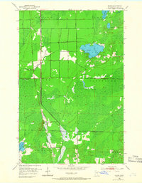
Editions of this 1953 Payne Map
3 editions found
Other maps of this area

1953 · Canyon
USGS Topo · 1:24,000

1953 · Payne
USGS Topo · 1:24,000

1953 · Alborn
USGS Topo · 1:24,000

1953 · Independence
USGS Topo · 1:24,000

1953 · Brookston NW
USGS Topo · 1:24,000

1953 · Duluth
USGS Topo · 1:250,000

1954 · Hibbing
USGS Topo · 1:250,000

1956 · Cotton
USGS Topo · 1:24,000

1957 · Hibbing
USGS Topo · 1:250,000

1958 · Hibbing
USGS Topo · 1:250,000