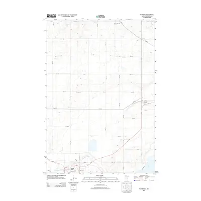
2013 Map of Paynesville
USGS Topo · Published 2013About this map
The N Fork Crow River meanders through the southern portion of this Stearns County landscape, anchoring the city of Paynesville. This area serves as a primary hub where MN-55 and MN-23 intersect, providing a glimpse into the regional transportation network that connects the Bonanza Valley to surrounding agricultural townships. To the north, the Sauk River clips the corner of the map near the settlement of Saint Martin, while the community of Roscoe sits further east along the highway corridor. For those researching local history, the map identifies several significant burial sites, including Salem Cem, Zion Cem, and Saint Louis Cem. The terrain is characterized by numerous small depressions and wetland pockets typical of central Minnesota's glaciated plains, with Rice Lake visible in the southeastern quadrant near the intersection of several local county highways.
Find a feature on this map
46 named features on this map. Tap any name to fly to it.
Don’t see what you’re looking for? This feature index may not catch every label — zoom into the map to look around manually.
Map Details
Editions of this 2013 Paynesville Map
This is the sole edition of this map. No revisions or reprints were ever made.
Other maps of this area

1953 · Saint Cloud
USGS Topo · 1:250,000

1957 · Saint Cloud
USGS Topo · 1:250,000

1958 · Saint Cloud
USGS Topo · 1:250,000

1965 · Farming
USGS Topo · 1:24,000

1965 · Greenwald
USGS Topo · 1:24,000

1965 · St Martin
USGS Topo · 1:24,000

1967 · Paynesville
USGS Topo · 1:24,000

1967 · Lake Koronis
USGS Topo · 1:24,000

1967 · Richmond
USGS Topo · 1:24,000

1967 · Hawick
USGS Topo · 1:24,000