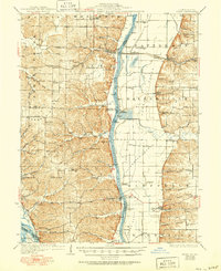
1930 Map of Pearl
USGS Topo · Published 1950About this map
The Illinois River cuts a wide valley through the heart of this region, separating the bluff-lined hills of Pike and Calhoun counties from the eastern agricultural plains of Walkerville and Patterson. This mid-century view reveals a landscape defined by its waterways and the drainage infrastructure necessary to farm the bottomlands, such as the Sny Island Levee near the Mississippi River. The Chicago and Alton RR serves as a primary transit artery, connecting the riverside settlement of Pearl to the inland village of Hillview. Genealogists will find a wealth of local landmarks including family-named sites like Miller Cem and Humphreys Cem, alongside rural social centers like Farmers Ridge Ch and Village Green Sch. From the river landing at Kampsville to the scattered hollows like Scott Hollow, the map documents the established rural network of post-war Illinois.
Find a feature on this map
88 named features on this map. Tap any name to fly to it.
Don’t see what you’re looking for? This feature index may not catch every label — zoom into the map to look around manually.
Map Details
Editions of this 1930 Pearl Map
3 editions found
Other maps of this area

1924 · Winchester
USGS Topo · 1:48,000

1924 · Roodhouse
USGS Topo · 1:62,500

1924 · Griggsville
USGS Topo · 1:62,500

1926 · Griggsville
USGS Topo · 1:62,500

1926 · Pittsfield
USGS Topo · 1:62,500

1926 · Winchester
USGS Topo · 1:62,500

1926 · Roodhouse
USGS Topo · 1:62,500

1930 · Pearl
USGS Topo · 1:62,500

1930 · Nebo
USGS Topo · 1:62,500

1930 · Hardin
USGS Topo · 1:62,500