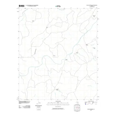
2010 Map of Pecan Springs
USGS Topo · Published 2010About this map
The San Saba River defines the central topography of this San Saba County landscape, winding past prominent geographical features like Horseshoe Bend and the Indian Hollow drainage. This 2010 survey documents a ranching-focused environment where water access is managed through named infrastructure like Sorrell Windmill and Indian Mound Windmill. The settlement at Pecan Springs sits near the confluence of Hinton Creek and Deer Creek, serving as a focal point for the surrounding cattle country.
Find a feature on this map
20 named features on this map. Tap any name to fly to it.
Don’t see what you’re looking for? This feature index may not catch every label — zoom into the map to look around manually.
Map Details
Editions of this 2010 Pecan Springs Map
This is the sole edition of this map. No revisions or reprints were ever made.
Other maps of this area

1885 · San Saba
USGS Topo · 1:125,000

1887 · Llano
USGS Topo · 1:125,000

1887 · Mason
USGS Topo · 1:125,000

1894 · Brady
USGS Topo · 1:125,000

1894 · Mason
USGS Topo · 1:125,000

1894 · San Saba
USGS Topo · 1:125,000

1894 · Llano
USGS Topo · 1:125,000

1904 · Llano
USGS Topo · 1:125,000

1909 · Llano
USGS Topo · 1:125,000

1918 · Llano
USGS Topo · 1:125,000