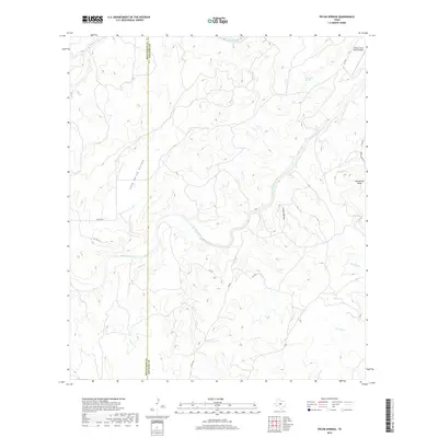
2019 Map of Pecan Springs
USGS Topo · Published 2019About this map
The San Saba River meanders across this Central Texas landscape, creating dramatic geographical features like the Horseshoe Bend as it flows toward the eastern edge of the quadrangle. This 2019 survey documents the border region between McCulloch and San Saba counties, where the river serves as a central lifeblood for the surrounding ranch land. The terrain is defined by complex drainage systems, including Long Valley Hollow and Indian Hollow, which feed into major tributaries like Brady Creek and Deer Cr. Private aviation infrastructure is represented by the Deep Creek Ranch Airport in the northeast corner, while a network of rural roads such as Co RD 208 and Deep Creek Rd provide access to the remote hills and springs, including Sycamore Springs.
Find a feature on this map
20 named features on this map. Tap any name to fly to it.
Don’t see what you’re looking for? This feature index may not catch every label — zoom into the map to look around manually.
Map Details
Editions of this 2019 Pecan Springs Map
This is the sole edition of this map. No revisions or reprints were ever made.
Other maps of this area

1885 · San Saba
USGS Topo · 1:125,000

1887 · Llano
USGS Topo · 1:125,000

1887 · Mason
USGS Topo · 1:125,000

1894 · Brady
USGS Topo · 1:125,000

1894 · Mason
USGS Topo · 1:125,000

1894 · San Saba
USGS Topo · 1:125,000

1894 · Llano
USGS Topo · 1:125,000

1904 · Llano
USGS Topo · 1:125,000

1909 · Llano
USGS Topo · 1:125,000

1918 · Llano
USGS Topo · 1:125,000