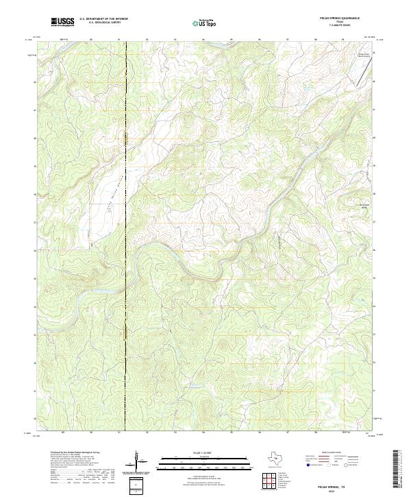
2022 Map of Pecan Springs
USGS Topo · Published 2022About this map
The San Saba River carves a winding path through this central Texas landscape, defining a terrain of deep hollows and limestone-fed water sources. Running through the heart of the region, the river forms a prominent loop at Horseshoe Bend before continuing eastward toward the county line. The land is characterized by significant topographical relief, where the McCulloch Co San Saba Co boundary bisects a network of drainages including Deer Cr, Hinton Cr, and Long Valley Hollow. Localized landmarks like Sycamore Springs and the Deep Creek Ranch Airport reveal a mix of natural riparian features and modern private aviation infrastructure. This modern survey tracks the intricate creek systems, from Brady Creek in the north to the various branches of W Deep Cr, illustrating the complex drainage patterns that shape the ranching country of the Edwards Plateau.
Find a feature on this map
19 named features on this map. Tap any name to fly to it.
Don’t see what you’re looking for? This feature index may not catch every label — zoom into the map to look around manually.
Map Details
Editions of this 2022 Pecan Springs Map
This is the sole edition of this map. No revisions or reprints were ever made.
Other maps of this area

1885 · San Saba
USGS Topo · 1:125,000

1887 · Llano
USGS Topo · 1:125,000

1887 · Mason
USGS Topo · 1:125,000

1894 · Brady
USGS Topo · 1:125,000

1894 · Mason
USGS Topo · 1:125,000

1894 · San Saba
USGS Topo · 1:125,000

1894 · Llano
USGS Topo · 1:125,000

1904 · Llano
USGS Topo · 1:125,000

1909 · Llano
USGS Topo · 1:125,000

1918 · Llano
USGS Topo · 1:125,000