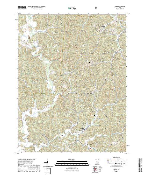
2023 Map of Pedro
USGS Topo · Published 2023About this map
The iron manufacturing legacy of southern Ohio is etched into the landscape of Wayne National Forest, where historical furnace sites and small settlements dot the rugged hollows. Evidence of the region’s industrial past remains at Buckhorn Furnace and Lawrence Furnace, markers of an era when local timber and ore fueled a sprawling iron industry. This 2023 survey preserves the locations of numerous family-named burial grounds, such as Finley Cem and Collins Cem, which are essential for genealogists tracing families in the Scioto and Lawrence County borderlands.
Find a feature on this map
92 named features on this map. Tap any name to fly to it.
Don’t see what you’re looking for? This feature index may not catch every label — zoom into the map to look around manually.
Map Details
Editions of this 2023 Pedro Map
This is the sole edition of this map. No revisions or reprints were ever made.
Other maps of this area

1898 · Ironton
USGS Topo · 1:62,500

1900 · Ironton
USGS Topo · 1:62,500

1911 · Sciotoville
USGS Topo · 1:62,500

1912 · Oak Hill
USGS Topo · 1:62,500

1913 · Sciotoville
USGS Topo · 1:62,500

1926 · Greenup
USGS Topo · 1:48,000

1930 · Greenup
USGS Topo · 1:62,500

1953 · Greenup
USGS Topo · 1:24,000
1953 · Ironton
USGS Topo · 1:24,000

1957 · Huntington
USGS Topo · 1:250,000