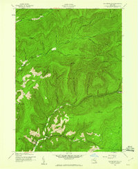
1943 Map of Peekamoose Mountain
USGS Topo · Published 1960About this map
The high peaks of the Catskills dominate this 1943 survey, which documents a landscape defined by steep ridges and isolated valley settlements in the heart of Ulster County. Tiny clusters of development like Denning and Sundown are linked by winding roads that follow the drainage patterns of the West Branch Neversink Creek and East Branch Neversink Creek. The area’s educational network is still visible through localized schoolhouses such as Denning Sch, Red Hill Sch, and Greenville Sch, serving a community tucked between massive formations like Peekamoose Mtn and Slide Mountain. Significant topographic features including Table Mountain and Rocky Mountain hem in the headwaters of Rondout Creek, while a Lookout Tower on the northern edge provides a vantage point over the Shandaken and Denning township borders during the early 1940s.
Find a feature on this map
39 named features on this map. Tap any name to fly to it.
Don’t see what you’re looking for? This feature index may not catch every label — zoom into the map to look around manually.
Map Details
Editions of this 1943 Peekamoose Mountain Map
3 editions found

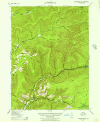
Other maps of this area

1900 · Phoenicia
USGS Topo · 1:62,500

1901 · Margaretville
USGS Topo · 1:62,500

1903 · Phoenicia
USGS Topo · 1:62,500

1903 · Slide Mountain
USGS Topo · 1:62,500

1904 · Margaretville
USGS Topo · 1:62,500

1905 · Slide Mountain
USGS Topo · 1:62,500

1910 · Neversink
USGS Topo · 1:62,500

1942 · West Shokan
USGS Topo · 1:24,000

1942 · Neversink
USGS Topo · 1:62,500

1942 · Lackawack
USGS Topo · 1:24,000