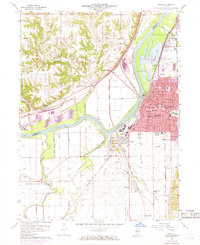
1960 Map of Pekin
USGS Topo · Published 1968About this map
The Illinois River serves as the central artery for this industrial and agricultural corridor during the late 1950s and 1960s. The city of Pekin dominates the eastern bank, showing a dense street grid from Sheridan Rd down to South St, anchored by local landmarks like Mineral Spring Park and the Hospital. Across the river, the landscape shifts toward the bluffs of Hollis and Limestone, where Gravel Pits and older community centers like Orchard Mines and Tuscarora sit near the Chicago and North Western tracks.
Find a feature on this map
80 named features on this map. Tap any name to fly to it.
Don’t see what you’re looking for? This feature index may not catch every label — zoom into the map to look around manually.
Map Details
Editions of this 1960 Pekin Map
3 editions found

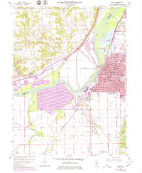
Other maps of this area

1905 · Peoria
USGS Topo · 1:62,500

1927 · Peoria
USGS Topo · 1:62,500

1929 · Manito
USGS Topo · 1:62,500

1930 · Glasford
USGS Topo · 1:62,500

1932 · Manito
USGS Topo · 1:62,500

1942 · Delavan
USGS Topo · 1:62,500

1948 · Glasford
USGS Topo · 1:62,500

1949 · Peoria East
USGS Topo · 1:24,000

1949 · Peoria West
USGS Topo · 1:24,000

1950 · Peoria West
USGS Topo · 1:24,000