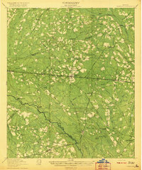
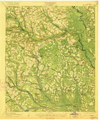
1920 Map of Pembroke
USGS Topo · Published 1920About this map
The Seaboard Air Line railroad anchors this survey of Southeast Georgia, passing through the growing community of Pembroke. The landscape is dominated by a complex network of wetlands and bays, including Boggy Pond and Mill Creek Bay, which drain into the winding Canoochee River. This era shows a distributed rural society supported by numerous small local institutions such as Stevens Grove School and Ash Branch Church. River navigation points like Mule Pen Landing and Floyd Landing suggest the continued importance of the waterway for commerce and transport alongside the burgeoning rail infrastructure. Local movement relied on landmarks like Moodys Bridge and Scott Ford, while smaller settlements like Groveland and Lanier served as outlying hubs for the surrounding timber and agricultural lands.
Find a feature on this map
69 named features on this map. Tap any name to fly to it.
Don’t see what you’re looking for? This feature index may not catch every label — zoom into the map to look around manually.
Map Details
Editions of this 1920 Pembroke Map
3 editions found
Other maps of this area

1918 · Hinesville
USGS Topo · 1:62,500

1919 · Claxton
USGS Topo · 1:62,500
1919 · Egypt
USGS Topo · 1:62,500
1920 · Pembroke
USGS Topo · 1:62,500

1920 · Statesboro
USGS Topo · 1:62,500

1920 · Glennville
USGS Topo · 1:62,500

1920 · Meldrim
USGS Topo · 1:62,500

1920 · Limerick
USGS Topo · 1:62,500
1921 · Brooklet
USGS Topo · 1:62,500
1939 · Egypt
USGS Topo · 1:62,500