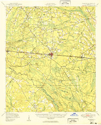
1950 Map of Pembroke
USGS Topo · Published 1950About this map
Pembroke serves as the central hub of this South Georgia landscape at mid-century, positioned along the busy Seaboard Air Line railway. The southern half of the map is dominated by the sprawling Camp Stewart Military Reservation, its boundary cutting through rural communities and pine-drained terrain. The geography is defined by an intricate network of wetland features, including Boggy Pond and Canoochee River, alongside several "bays" or swamps like Strum Bay and Big Brier Bay. Genealogists will find a wealth of local landmarks, from the Beautiful Zion Ch and Beulah Ch to scattered family-named cemeteries such as Elarbee Cem and Stevens Grove Cem. The presence of small, dispersed schoolhouses like Eela Sch and Midway Sch illustrates the rural educational structure of Bryan and Bulloch counties before the consolidation era.
Find a feature on this map
65 named features on this map. Tap any name to fly to it.
Don’t see what you’re looking for? This feature index may not catch every label — zoom into the map to look around manually.
Map Details
Editions of this 1950 Pembroke Map
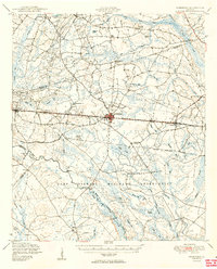
2 editions found
Other maps of this area

1918 · Hinesville
USGS Topo · 1:62,500

1919 · Claxton
USGS Topo · 1:62,500

1919 · Egypt
USGS Topo · 1:62,500

1920 · Pembroke
USGS Topo · 1:62,500

1920 · Statesboro
USGS Topo · 1:62,500

1920 · Glennville
USGS Topo · 1:62,500

1920 · Meldrim
USGS Topo · 1:62,500

1920 · Limerick
USGS Topo · 1:62,500

1921 · Brooklet
USGS Topo · 1:62,500

1939 · Egypt
USGS Topo · 1:62,500