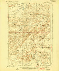
1941 Map of Pendroy
USGS Topo · Published 1941About this map
The Great Northern railway line terminates at Pendroy, serving as a vital transport hub for the ranching and mining operations of the northern Montana plains. This 1930s-era landscape, straddling the Pondera and Teton County line, is defined by an extensive network of family-held properties including the Soberup Ranch, Sullivan Ranch, and Innes Ranch. The irrigation of the semi-arid terrain is evident through the complex system of the Bynum Canal and Jones Canal, which divert water to support local agriculture.
Find a feature on this map
39 named features on this map. Tap any name to fly to it.
Don’t see what you’re looking for? This feature index may not catch every label — zoom into the map to look around manually.
Map Details
Editions of this 1941 Pendroy Map
2 editions found

Other maps of this area

1903 · Saypo
USGS Topo · 1:125,000

1914 · Heart Butte
USGS Topo · 1:125,000

1918 · Heart Butte
USGS Topo · 1:125,000

1920 · Choteau
USGS Topo · 1:125,000

1920 · Dupuyer
USGS Topo · 1:125,000

1934 · Lake Frances
USGS Topo · 1:48,000

1934 · Valier
USGS Topo · 1:62,500

1936 · Pendroy
USGS Topo · 1:48,000

1937 · Valier
USGS Topo · 1:62,500

1937 · Lake Frances
USGS Topo · 1:62,500
Featured Places
- Pendroy, MT
- Rockport Hutterite Colony, MT
- Pondera Hutterite Colony, MT
- Birch Creek Hutterite Colony, MT
- New Miami Hutterite Colony, MT