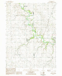
1984 Map of Penfield
USGS Topo · Published 1985About this map
The Middle Fork Vermilion River carves a winding path through this corner of East Central Illinois, defining the landscape between the townships of Butler and Kerr. In the early 1980s, the rural character of the area remained centered on agricultural settlements and ancestral burial grounds. Genealogists will find several notable family-named sites, including Tomlinson Cem, Chenoweth Cem, and Wells Cem, alongside the St Lawrence Cem in Penfield. The village of Armstrong serves as a small hub to the east, anchored by a High Sch and located along the Missouri Pacific railroad line. To the north, the Middle Fork River Forest Preserve provides a large protected area where Spring and Sugar Creek converge, reflecting the transition of the riparian corridor from active farmland into conservation space.
Find a feature on this map
26 named features on this map. Tap any name to fly to it.
Don’t see what you’re looking for? This feature index may not catch every label — zoom into the map to look around manually.
Map Details
Editions of this 1984 Penfield Map
This is the sole edition of this map. No revisions or reprints were ever made.
Other maps of this area
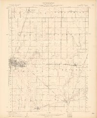
1906 · Urbana
USGS Topo · 1:62,500
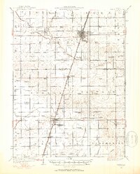
1924 · Paxton
USGS Topo · 1:62,500
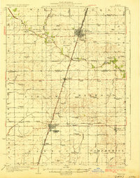
1927 · Paxton
USGS Topo · 1:62,500
1931 · Fithian
USGS Topo · 1:48,000
1936 · Potomac
USGS Topo · 1:62,500
1943 · Fithian
USGS Topo · 1:62,500
1949 · Paxton
USGS Topo · 1:62,500

1953 · Danville
USGS Topo · 1:250,000

1955 · Danville
USGS Topo · 1:250,000

1956 · Danville
USGS Topo · 1:250,000