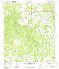
1949 Map of Penney Farms
USGS Topo · Published 1980About this map
Penney Farms serves as the focal point of this Clay County landscape, appearing here in a survey based on late 1940s field checks with 1970s photographic revisions. The map details the planned character of the community, highlighting the Memorial Homes complex and the Penney Farms Sch at the center of the local grid. Surrounding the town, the terrain is defined by a dense network of waterways, including the winding Black Creek South Fork, Greens Creek, and Peters Creek.
Find a feature on this map
15 named features on this map. Tap any name to fly to it.
Don’t see what you’re looking for? This feature index may not catch every label — zoom into the map to look around manually.
Map Details
Editions of this 1949 Penney Farms Map
4 editions found
Other maps of this area

1917 · Orange Park
USGS Topo · 1:62,500

1918 · Middleburg
USGS Topo · 1:62,500

1918 · Orange Park
USGS Topo · 1:62,500

1941 · Middleburg
USGS Topo · 1:62,500

1942 · Ates Creek
USGS Topo · 1:62,500

1947 · Bostwick
USGS Topo · 1:50,000

1948 · Jacksonville
USGS Topo · 1:250,000

1949 · Rice Creek
USGS Topo · 1:24,000

1949 · Bostwick
USGS Topo · 1:24,000

1949 · Middleburg SW
USGS Topo · 1:24,000