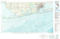
1978 Map of Pensacola
USGS Topo · Published 1980About this map
Pensacola and its surrounding coastal reaches are defined by a complex network of bays and inlets along the Alabama-Florida border during the late 1970s. This topographic-bathymetric study details the established urban centers of West Pensacola and Myrtle Grove, while also highlighting the extensive military footprint of the Pensacola Naval Air Station and Saufley Field. The landscape transitions from the developed shores of Pensacola Bay to the quieter reaches of Baldwin County, where smaller settlements like Magnolia Springs and Bon Secour sit near the winding Magnolia River.
Find a feature on this map
86 named features on this map. Tap any name to fly to it.
Don’t see what you’re looking for? This feature index may not catch every label — zoom into the map to look around manually.
Map Details
Editions of this 1978 Pensacola Map
3 editions found
Other maps of this area

1920 · Milton
USGS Topo · 1:62,500

1920 · Robertsdale
USGS Topo · 1:62,500

1921 · Holley
USGS Topo · 1:62,500

1921 · Bon Secour
USGS Topo · 1:62,500

1921 · Pensacola
USGS Topo · 1:62,500

1921 · Point Clear
USGS Topo · 1:62,500

1921 · Fairhope
USGS Topo · 1:62,500

1921 · Dauphin Island
USGS Topo · 1:62,500

1921 · Fort Barrancas
USGS Topo · 1:62,500

1921 · Muscogee
USGS Topo · 1:62,500