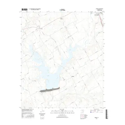
2016 Map of Peoria
USGS Topo · Published 2016About this map
Aquilla Lake dominates the central landscape of this Hill County survey, its sprawling shoreline reaching into the heart of a largely agricultural region. To the north, the settlement of Peoria sits near the intersection of several farm roads, while the community of Vaughan is situated to the southeast of the reservoir. The topography is defined by numerous drainage systems, including Aquilla Cr, Dead Horse Cr, and Cobb Cr, which feed the lake basin. For those researching local families, several burial grounds are preserved on the landscape, notably Hillcrest Garden of Memory Cem near the northern boundary and the Vaughan Cem further south. The map reflects a modern Texas landscape where traditional ranching and farming roads, such as FM 1947 and FM 3110, now navigate around the significant water management infrastructure of the dam and its accompanying lake.
Find a feature on this map
70 named features on this map. Tap any name to fly to it.
Don’t see what you’re looking for? This feature index may not catch every label — zoom into the map to look around manually.
Map Details
Editions of this 2016 Peoria Map
This is the sole edition of this map. No revisions or reprints were ever made.
Other maps of this area

1891 · Cleburne
USGS Topo · 1:125,000

1892 · Waco
USGS Topo · 1:125,000

1894 · Cleburne
USGS Topo · 1:125,000

1920 · Waco
USGS Topo · 1:125,000

1927 · Blum
USGS Topo · 1:62,500

1931 · Whitney
USGS Topo · 1:62,500

1954 · Dallas
USGS Topo · 1:250,000

1954 · Waco
USGS Topo · 1:250,000

1955 · Waco
USGS Topo · 1:250,000

1956 · Abbott
USGS Topo · 1:24,000