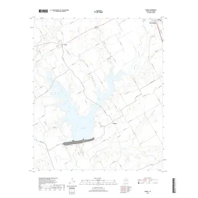
2019 Map of Peoria
USGS Topo · Published 2019About this map
Aquilla Lake dominates the central landscape of this Hill County region, its irregular shoreline reaching north from a prominent dam structure. The settlement of Vaughan sits just east of the lake's southern reaches, while the village of Peoria is situated to the northwest at the intersection of several local routes, including FM 1947. This 2019 survey reflects a modern landscape where reservoir management and rural transportation networks define the area's geography.
Find a feature on this map
67 named features on this map. Tap any name to fly to it.
Don’t see what you’re looking for? This feature index may not catch every label — zoom into the map to look around manually.
Map Details
Editions of this 2019 Peoria Map
This is the sole edition of this map. No revisions or reprints were ever made.
Other maps of this area

1891 · Cleburne
USGS Topo · 1:125,000

1892 · Waco
USGS Topo · 1:125,000

1894 · Cleburne
USGS Topo · 1:125,000

1920 · Waco
USGS Topo · 1:125,000

1927 · Blum
USGS Topo · 1:62,500

1931 · Whitney
USGS Topo · 1:62,500

1954 · Dallas
USGS Topo · 1:250,000

1954 · Waco
USGS Topo · 1:250,000

1955 · Waco
USGS Topo · 1:250,000

1956 · Abbott
USGS Topo · 1:24,000