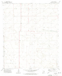
1972 Map of Pep
USGS Topo · Published 1975About this map
Pep and the surrounding plains of Roosevelt County are defined by a scattered network of agricultural settlements and industrial infrastructure in the early 1970s. This survey documents a landscape of essential utilities and rural community centers, from the cluster at Richland to the southern outpost of Dean. The presence of numerous Wells and a prominent Pipeline underscores the critical role of water and energy resources in sustaining these high plains communities.
Find a feature on this map
11 named features on this map. Tap any name to fly to it.
Don’t see what you’re looking for? This feature index may not catch every label — zoom into the map to look around manually.
Map Details
Editions of this 1972 Pep Map
This is the sole edition of this map. No revisions or reprints were ever made.
Other maps of this area

1954 · Brownfield
USGS Topo · 1:250,000

1958 · Brownfield
USGS Topo · 1:250,000

1962 · Brownfield
USGS Topo · 1:250,000

1972 · Bluit
USGS Topo · 1:24,000

1972 · Dora NW
USGS Topo · 1:24,000

1972 · Garrison
USGS Topo · 1:24,000

1972 · Milnesand
USGS Topo · 1:24,000

1972 · Dora SW
USGS Topo · 1:24,000
1972 · Causey West
USGS Topo · 1:24,000
1972 · Milnesand NW
USGS Topo · 1:24,000