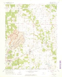
1965 Map of Percy
USGS Topo · Published 1966About this map
The boundary between Randolph Co and Perry Co bisects this landscape of Southern Illinois, where a massive Strip Mine dominates the western terrain. The industrial footprint of the mid-1960s is clearly visible, with the extensive excavations of the mine complex situated just north of the village of Percy. Transport infrastructure defines the local economy, as the Missouri Pacific and the Gulf Mobile and Ohio railroads intersect to serve the coal and agricultural interests of the region.
Find a feature on this map
25 named features on this map. Tap any name to fly to it.
Don’t see what you’re looking for? This feature index may not catch every label — zoom into the map to look around manually.
Map Details
Editions of this 1965 Percy Map
3 editions found
Other maps of this area

1910 · Murphysboro
USGS Topo · 1:62,500

1914 · Coulterville
USGS Topo · 1:62,500

1916 · Campbell Hill
USGS Topo · 1:62,500

1917 · Coulterville
USGS Topo · 1:62,500

1918 · Campbell Hill
USGS Topo · 1:62,500

1924 · Pinckneyville
USGS Topo · 1:62,500

1926 · Pinckneyville
USGS Topo · 1:62,500

1938 · Murphysboro
USGS Topo · 1:62,500

1949 · Paducah
USGS Topo · 1:250,000

1950 · Paducah
USGS Topo · 1:250,000