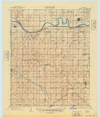
1909 Map of Perkins
USGS Topo · Published 1949About this map
The winding Cimarron River carves a central path through this early 20th-century landscape at the junction of Logan, Payne, and Lincoln counties. This era reveals a dense network of rural infrastructure, where nearly every section of land is served by a localized country schoolhouse, such as IXL School, Prairie Gem School, and the uniquely named Eagle College School. The settlement pattern is defined by the burgeoning rail industry, with the Atchison Topeka and Santa Fe RR and the Chicago Rock Island and Pacific RR intersecting at key nodes.
Find a feature on this map
68 named features on this map. Tap any name to fly to it.
Don’t see what you’re looking for? This feature index may not catch every label — zoom into the map to look around manually.
Map Details
Editions of this 1909 Perkins Map
4 editions found
Other maps of this area

1892 · Guthrie
USGS Topo · 1:62,500

1892 · Edmond
USGS Topo · 1:62,500

1893 · Mulhall
USGS Topo · 1:62,500

1893 · Stillwater
USGS Topo · 1:62,500

1905 · Chandler
USGS Topo · 1:62,500

1907 · Chandler
USGS Topo · 1:62,500

1908 · Agra
USGS Topo · 1:62,500

1909 · Luther
USGS Topo · 1:62,500

1909 · Perkins
USGS Topo · 1:62,500

1929 · Ripley
USGS Topo · 1:62,500