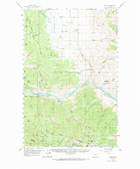
1959 Map of Perma
USGS Topo · Published 1969About this map
The Flathead River serves as the central artery through this western Montana landscape, flanked by the rugged terrain of the Lolo National Forest and the Flathead Indian Reservation. At the river's bend, the settlement of Perma sits at a critical junction where the Northern Pacific railroad tracks follow the water's edge, passing through the Teddy Tunnel to the west. Evidence of the region’s early infrastructure is visible in the Racehorse Ferry crossing and the presence of the Camas Substation north of the river.
Find a feature on this map
42 named features on this map. Tap any name to fly to it.
Don’t see what you’re looking for? This feature index may not catch every label — zoom into the map to look around manually.
Map Details
Editions of this 1959 Perma Map
2 editions found
Other maps of this area

1920 · Flathead Lake
USGS Topo · 1:125,000

1956 · Wallace
USGS Topo · 1:250,000

1959 · Tarkio
USGS Topo · 1:62,500

1959 · Alberton
USGS Topo · 1:62,500

1959 · Perma
USGS Topo · 1:62,500

1959 · Plains
USGS Topo · 1:62,500

1960 · Wallace
USGS Topo · 1:250,000

1960 · Superior
USGS Topo · 1:62,500

1964 · Mc Donald
USGS Topo · 1:24,000

1964 · Melton Ranch
USGS Topo · 1:24,000