1973 Map of Perry
USGS Topo · Published 1975About this map
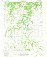
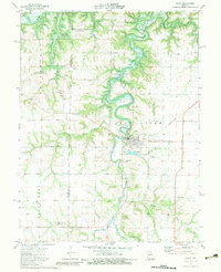
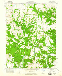
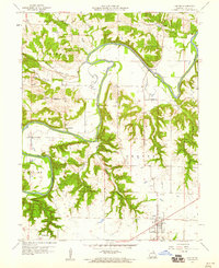
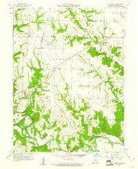
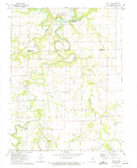
Perry and its surrounding countryside in the early 1970s are defined by the winding course of the Salt River and its numerous tributaries. This period marks a major landscape transition, with the Clarence Cannon Reservoir shown at an elevation of 606 feet, including blue hatching indicating areas subject to controlled inundation. The map provides significant genealogical value, documenting numerous rural burial sites such as Scobee Cem, Muldrow Cem, and the Old Mt Prairie Cem near Mt Prairie Ch. Evidence of earlier transport and utility networks remains visible through an Old Railroad Grade and the Gough Landing Strip. Smaller rural hubs like Greenlawn and Gallaher punctuate the landscape, while the local infrastructure includes a Sewage Disposal Pond and City Lakes near the town center.
Find a feature on this map
32 named features on this map. Tap any name to fly to it.
Don’t see what you’re looking for? This feature index may not catch every label — zoom into the map to look around manually.
Map Details
Editions of this 1973 Perry Map
2 editions found
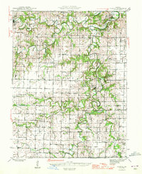
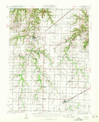
Other maps of this area

1890 · Mexico
USGS Topo · 1:125,000

1903 · Palmyra
USGS Topo · 1:125,000
1945 · Florida
USGS Topo · 1:62,500
1945 · Perry
USGS Topo · 1:62,500

1948 · Quincy
USGS Topo · 1:250,000

1956 · Quincy
USGS Topo · 1:250,000
1959 · Joanna
USGS Topo · 1:24,000
1959 · Center
USGS Topo · 1:24,000
1960 · Stoutsville
USGS Topo · 1:24,000
1972 · Santa Fe
USGS Topo · 1:24,000