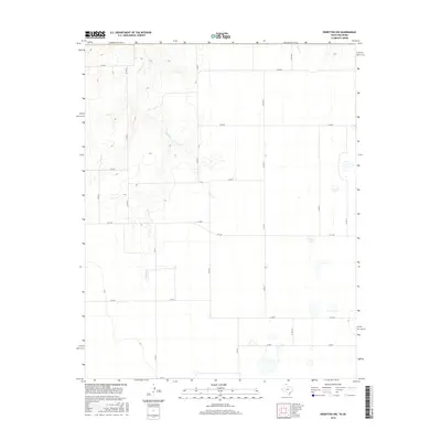
2016 Map of Perryton NW
USGS Topo · Published 2016About this map
Chiquita Cr winds through the northwestern corner of this High Plains landscape, cutting a distinct drainage pattern into the high desert plateau. This 2016 survey by the U.S. Geological Survey shows a meticulously organized grid of section roads, including Co Rd 8 and Co Rd 10, which define the agricultural boundaries of the region. The map highlights the intersection of modern infrastructure and natural watercourses, such as where Fm 1267 traverses the southern portion of the quadrangle. Small playas and localized depressions dot the eastern plains near Co Rd 12, indicating the characteristic hydrology of the Oklahoma Panhandle. This map serves as a clear record of the rural road network and drainage systems that support the area's ranching and farming operations.
Find a feature on this map
19 named features on this map. Tap any name to fly to it.
Don’t see what you’re looking for? This feature index may not catch every label — zoom into the map to look around manually.
Map Details
Editions of this 2016 Perryton NW Map
This is the sole edition of this map. No revisions or reprints were ever made.
Other maps of this area

1954 · Perryton
USGS Topo · 1:250,000

1958 · Perryton
USGS Topo · 1:250,000

1968 · Hardesty SE
USGS Topo · 1:24,000

1973 · Farnsworth
USGS Topo · 1:24,000

1973 · Horseshoe Hill
USGS Topo · 1:24,000

1973 · Perryton SE
USGS Topo · 1:24,000

1973 · Perryton
USGS Topo · 1:24,000

1973 · Waka
USGS Topo · 1:24,000

1973 · Bryans Corner SW
USGS Topo · 1:24,000

1973 · Bryans Corner
USGS Topo · 1:24,000