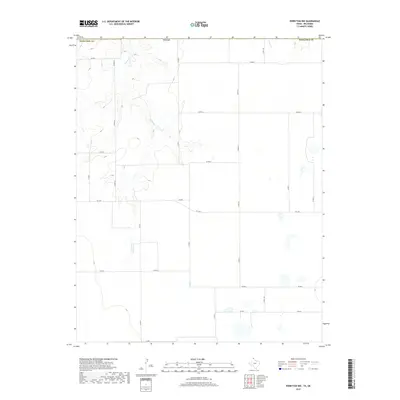
2019 Map of Perryton NW
USGS Topo · Published 2019About this map
Chiquita Cr winds through the northern portion of this Texas County landscape, providing a rare natural drainage pattern in a region defined by its rigid section-line road grid. The map illustrates the agricultural and ranching infrastructure of the late 2010s, where county roads like Co RD 8 and Co RD 10 form a precise network across the high plains. The boundary with Ochiltree Co, Texas, is clearly delineated at the northern edge, marking the transition between states. This area is characterized by scattered wetlands and small depressions that punctuate the flat terrain between the ephemeral flows of Sand Cr. The modern layout of farm-to-market roads, specifically FM 1267, highlights the connectivity required for the local rural economy.
Find a feature on this map
21 named features on this map. Tap any name to fly to it.
Don’t see what you’re looking for? This feature index may not catch every label — zoom into the map to look around manually.
Map Details
Editions of this 2019 Perryton NW Map
This is the sole edition of this map. No revisions or reprints were ever made.
Other maps of this area

1954 · Perryton
USGS Topo · 1:250,000

1958 · Perryton
USGS Topo · 1:250,000

1968 · Hardesty SE
USGS Topo · 1:24,000

1973 · Farnsworth
USGS Topo · 1:24,000

1973 · Horseshoe Hill
USGS Topo · 1:24,000

1973 · Perryton SE
USGS Topo · 1:24,000

1973 · Perryton
USGS Topo · 1:24,000

1973 · Waka
USGS Topo · 1:24,000

1973 · Bryans Corner SW
USGS Topo · 1:24,000

1973 · Bryans Corner
USGS Topo · 1:24,000