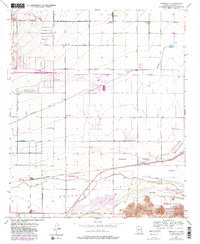
1957 Map of Perryville
USGS Topo · Published 1983About this map
Agricultural development and industrial infrastructure define this portion of the Buckeye Valley during the mid-20th century. The landscape is crisscrossed by a sophisticated irrigation network including the Beardsley Canal and the Roosevelt Canal, which support the farms surrounding Perryville and Goodyear. The southern edge of the map is dominated by the Gila River and the northern slopes of Estrella Mountain Regional Park, while the northern section transitions into the White Tanks Proving Grounds. Transportation and commerce are centered on the Southern Pacific rail line and aviation facilities like the Phoenix-Litchfield Municipal Airport. One notable landmark of the era is the Phoenix Trotting Park, appearing here alongside a labor camp and the Liberty Siding, reflecting the diverse social and economic activities of the valley floor.
Find a feature on this map
43 named features on this map. Tap any name to fly to it.
Don’t see what you’re looking for? This feature index may not catch every label — zoom into the map to look around manually.
Map Details
Editions of this 1957 Perryville Map
5 editions found
Other maps of this area

1946 · Avondale
USGS Topo · 1:62,500

1948 · Cashion
USGS Topo · 1:62,500

1954 · Phoenix
USGS Topo · 1:250,000

1957 · Phoenix
USGS Topo · 1:250,000

1957 · White Tank Mts. SE
USGS Topo · 1:24,000

1957 · Valencia
USGS Topo · 1:24,000

1957 · Perryville
USGS Topo · 1:24,000

1957 · El Mirage
USGS Topo · 1:24,000

1957 · Waddell
USGS Topo · 1:24,000

1957 · Tolleson
USGS Topo · 1:24,000