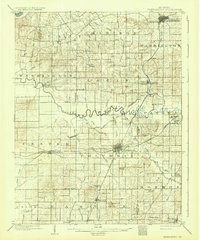
1903 Map of Petersburg
USGS Topo · Published 1932About this map
Petersburg and Oakland City serve as the primary hubs in this turn-of-the-century landscape, connected by a network of railroads including the Southern and the Louisville and St. Louis. The meandering Patoka River bisects the region, flanked by smaller settlements like Dongola and Glezen. The coal industry is clearly emerging in the east, evidenced by the Massey Mine, Aberdeen Mine, and Ingle Mine, while an Artesian Well marks the northern edge of the county seat.
Find a feature on this map
73 named features on this map. Tap any name to fly to it.
Don’t see what you’re looking for? This feature index may not catch every label — zoom into the map to look around manually.
Map Details
Editions of this 1903 Petersburg Map
2 editions found
Other maps of this area

1900 · De Gonia Springs
USGS Topo · 1:62,500

1901 · Princeton
USGS Topo · 1:62,500

1901 · Haubstadt
USGS Topo · 1:62,500

1902 · Ditney
USGS Topo · 1:125,000

1902 · Degonia Springs
USGS Topo · 1:62,500

1902 · Boonville
USGS Topo · 1:62,500

1903 · Velpen
USGS Topo · 1:62,500

1903 · Haubstadt
USGS Topo · 1:62,500

1903 · Petersburg
USGS Topo · 1:62,500

1903 · Princeton
USGS Topo · 1:62,500