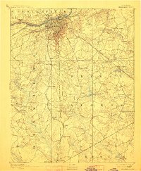
1894 Map of Petersburg
USGS Topo · Published 1912About this map
Petersburg and its surrounding counties appear here just before the turn of the century, still bearing the distinct scars and landmarks of the Civil War. The city sits at the fall line of the Appomattox River, where the Battersea Canal and various mills like Crawford's Mill and Smith's Mill fueled the local economy. Beyond the urban grid of Blandford and Pocahontas, the map details a landscape heavily defined by its transit history, from the Jerusalem Plank Road and Stage Road to the convergence of the Atlantic Coast Line Railroad and Norfolk and Western Railroad.
Find a feature on this map
73 named features on this map. Tap any name to fly to it.
Don’t see what you’re looking for? This feature index may not catch every label — zoom into the map to look around manually.
Map Details
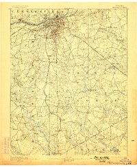
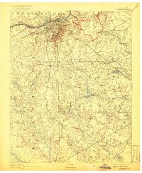
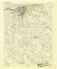
Editions of this 1894 Petersburg Map
6 editions found

Other maps of this area

1894 · Bermuda Hundred
USGS Topo · 1:62,500

1894 · Petersburg
USGS Topo · 1:62,500

1897 · Amelia
USGS Topo · 1:125,000

1918 · Charles City
USGS Topo · 1:62,500

1919 · Jarratt
USGS Topo · 1:62,500

1919 · Mc Kenney
USGS Topo · 1:48,000

1919 · Disputanta
USGS Topo · 1:62,500

1919 · Homeville
USGS Topo · 1:48,000

1920 · Homeville
USGS Topo · 1:62,500

1921 · Mc Kenney
USGS Topo · 1:62,500