
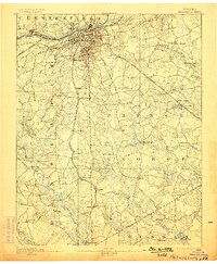
1894 Map of Petersburg
USGS Topo · Published 1945About this map
Petersburg and its industrial outskirts dominate the northern edge of this survey, where the Appomattox River meets a complex web of transportation. Just southeast of the city, The Crater and the National Cemetery stand as significant landmarks of the American Civil War, surrounded by suburban developments like Blandford, Ettricks, and Pocahontas. Further south, the landscape shifts into rural Dinwiddie and Prince George counties, defined by sprawling swamp systems such as Blackwater Swamp and Rowanty Creek.
Find a feature on this map
70 named features on this map. Tap any name to fly to it.
Don’t see what you’re looking for? This feature index may not catch every label — zoom into the map to look around manually.
Map Details
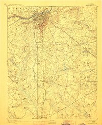
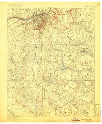
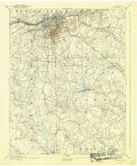
Editions of this 1894 Petersburg Map
6 editions found
Other maps of this area

1894 · Bermuda Hundred
USGS Topo · 1:62,500

1894 · Petersburg
USGS Topo · 1:62,500

1897 · Amelia
USGS Topo · 1:125,000

1918 · Charles City
USGS Topo · 1:62,500

1919 · Jarratt
USGS Topo · 1:62,500

1919 · Mc Kenney
USGS Topo · 1:48,000

1919 · Disputanta
USGS Topo · 1:62,500

1919 · Homeville
USGS Topo · 1:48,000

1920 · Homeville
USGS Topo · 1:62,500

1921 · Mc Kenney
USGS Topo · 1:62,500