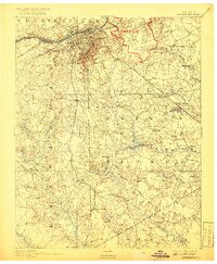
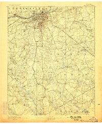
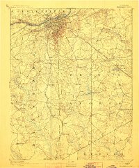
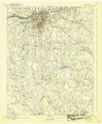
1894 Map of Petersburg
USGS Topo · Published 1917About this map
Petersburg and its surrounding communities are captured here during a period of transition as the region rebuilt after the war. The map reveals a landscape defined by significant Civil War landmarks, including the site of The Crater and the National Cemetery. Industrial and agricultural activity is evident through numerous rural water mills like Smith's Mill and Rowland's Mill, which utilized the complex drainage system of the Blackwater Swamp and Warwick Swamp. Transportation networks are dominated by the Norfolk and Western Railroad and the Atlantic Coast Line Railroad, which facilitated trade and movement across the county lines of Dinwiddie and Prince George. The presence of Camp Lee near Blandford signals the military's continued importance to the area's development during the early 20th century.
Find a feature on this map
67 named features on this map. Tap any name to fly to it.
Don’t see what you’re looking for? This feature index may not catch every label — zoom into the map to look around manually.
Map Details
Editions of this 1894 Petersburg Map
6 editions found

Other maps of this area

1894 · Bermuda Hundred
USGS Topo · 1:62,500

1894 · Petersburg
USGS Topo · 1:62,500

1897 · Amelia
USGS Topo · 1:125,000

1918 · Charles City
USGS Topo · 1:62,500

1919 · Jarratt
USGS Topo · 1:62,500

1919 · Mc Kenney
USGS Topo · 1:48,000

1919 · Disputanta
USGS Topo · 1:62,500

1919 · Homeville
USGS Topo · 1:48,000

1920 · Homeville
USGS Topo · 1:62,500

1921 · Mc Kenney
USGS Topo · 1:62,500