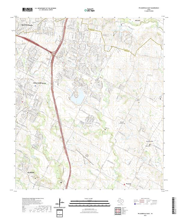
2022 Map of Pflugerville East
USGS Topo · Published 2022About this map
Pflugerville and the surrounding Travis and Williamson County plains are captured in this recent survey, showcasing a landscape where suburban growth meets deep-rooted agricultural history. The map documents the rapid expansion of the corridor along the TX State Hwy 130 Service Road, which now bisects the rolling terrain near the Austin Executive Airport. Despite the modern infrastructure, the rural heritage of the area is preserved in the numerous cemeteries and historic church sites that dot the countryside, such as Saint John Evangelical Lutheran Cem and New Sweden Lutheran Cem.
Find a feature on this map
44 named features on this map. Tap any name to fly to it.
Don’t see what you’re looking for? This feature index may not catch every label — zoom into the map to look around manually.
Map Details
Editions of this 2022 Pflugerville East Map
This is the sole edition of this map. No revisions or reprints were ever made.
Other maps of this area

1885 · Taylor
USGS Topo · 1:125,000

1885 · Bastrop
USGS Topo · 1:125,000

1887 · Taylor
USGS Topo · 1:125,000

1893 · Georgetown
USGS Topo · 1:125,000

1893 · Bastrop
USGS Topo · 1:125,000

1894 · Taylor
USGS Topo · 1:125,000

1896 · Austin
USGS Topo · 1:125,000

1897 · Austin
USGS Topo · 1:125,000

1904 · Bastrop
USGS Topo · 1:125,000

1910 · Austin
USGS Topo · 1:125,000