1956 Map of Phelan
USGS Topo · Published 1970About this map
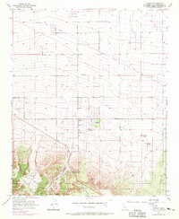
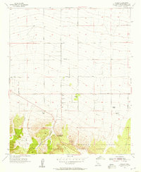
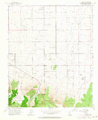
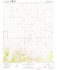
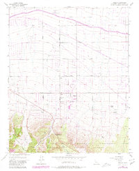
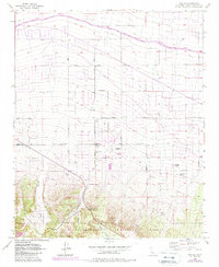
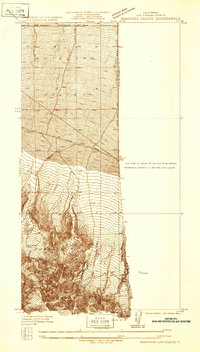
Phelan and the surrounding high desert ranchlands are captured here during a period of transitional growth, with revisions from 1968 showing new residential developments and roads superimposed over the original 1956 land patterns. The landscape is defined by the steep descent from the San Bernardino National Forest into the alluvial fans of the Mojave Desert. Named family properties like Goss Ranch, Johnson Ranch, and Buttemer Ranch emphasize the area's agricultural roots, while the presence of the Yucca Inn and the Fire Control Station at Phelan point to the community's role as a desert crossroads. To the south, the topography dramatically shifts at Cajon Canyon and Horse Canyon, where the rugged mountain slopes meet the valley floor. Transportation corridors such as Phelan Road and Beekley Road connect these ranching outposts, while industrial features like a Quarry and scattered wells reflect the local extraction economy.
Find a feature on this map
33 named features on this map. Tap any name to fly to it.
Don’t see what you’re looking for? This feature index may not catch every label — zoom into the map to look around manually.
Map Details
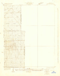
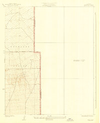
Editions of this 1956 Phelan Map
6 editions found
Other maps of this area

1901 · Southern California Sheet No. 1
USGS Topo · 1:250,000

1902 · Hesperia
USGS Topo · 1:62,500

1903 · San Antonio
USGS Topo · 1:62,500

1904 · Southern California Sheet No. 1
USGS Topo · 1:250,000
1930 · Angle
USGS Topo · 1:24,000
1932 · Angle
USGS Topo · 1:24,000

1932 · Barstow
USGS Topo · 1:125,000

1934 · Barstow
USGS Topo · 1:125,000
1934 · Boneyard Canyon
USGS Topo · 1:24,000
1936 · Swarthout
USGS Topo · 1:24,000